MAPS
How to get there
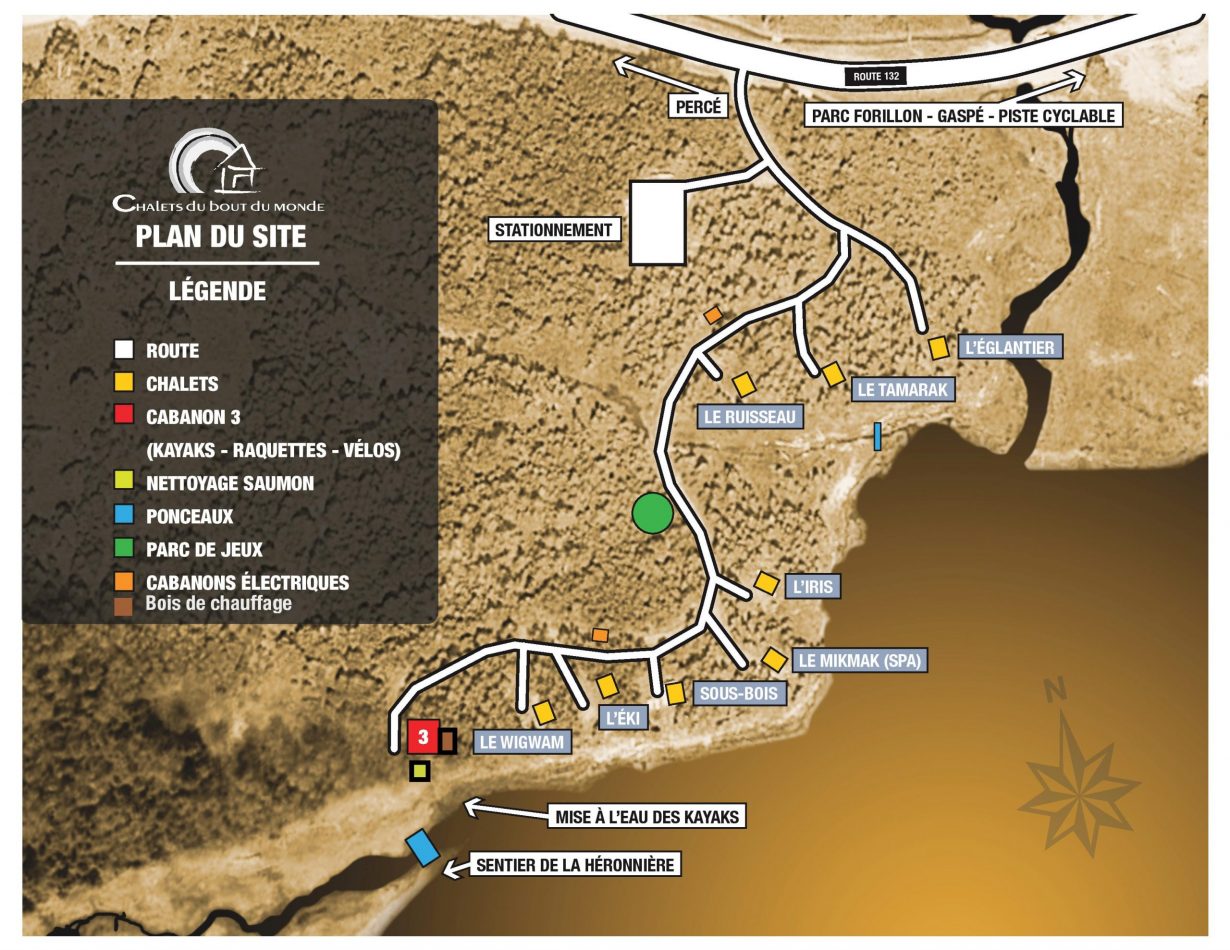
PLAN DU SITE
All our cottages are on the waterfront with a south and south-east orientation and a magnificent view of the water. They are all separated by a small forest which gives them privacy and all have private parking next to the chalet. ➢ 40 min from Forillon national parc ➢ 45 min from Perce ➢ 2 min from haldimand beach and the cycling path ➢ 10 min from gaspé down town ➢ 1 h45 from Chic-Chocs provincial parc
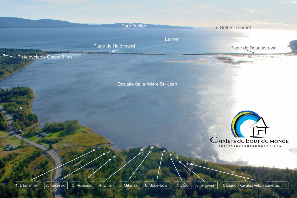
map of gaspe beaches
La piste cyclable
Our cycle path begins 2 km from the chalets and runs along the cliffs to Gaspé city center. All in asphalt and almost no difference in altitude. With an ice cream at the end of the road, a 5 year old child can easily get to Gaspé!
LA ZONE KAYAK
The safe zone on the map is very shallow. Kayaks can only be used when the tide allows (end of the rise and start of the fall). Refer to the tide table on the internet.
Questions?
Your feedback is important to us.